
What We Deliver
From community-scale 3D models to interior walkthroughs and progression video, we help teams communicate projects with clarity and impact.
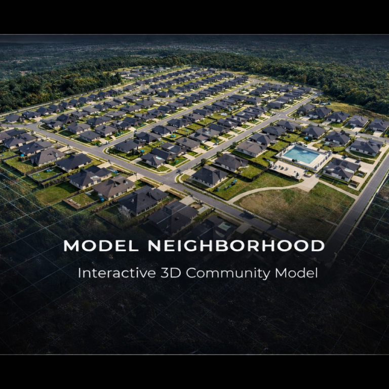
Gives developers and stakeholders a complete visual overview of the entire project footprint, lot layout, amenities, and spatial relationships — all without being on-site.
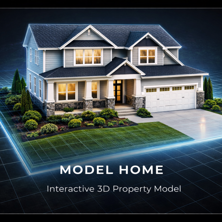
Allows teams to showcase individual builds in full 3D detail, supporting pre-sales, investor presentations, and design validation before completion.
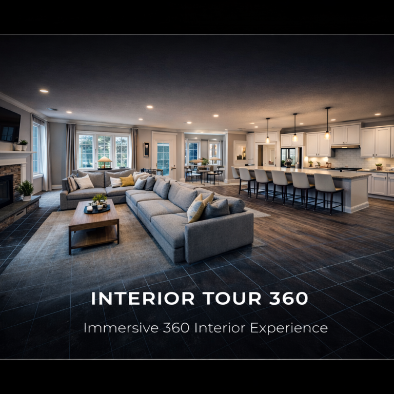
Provides remote walkthrough access for decision-makers, buyers, and stakeholders — reducing unnecessary site visits while increasing engagement.
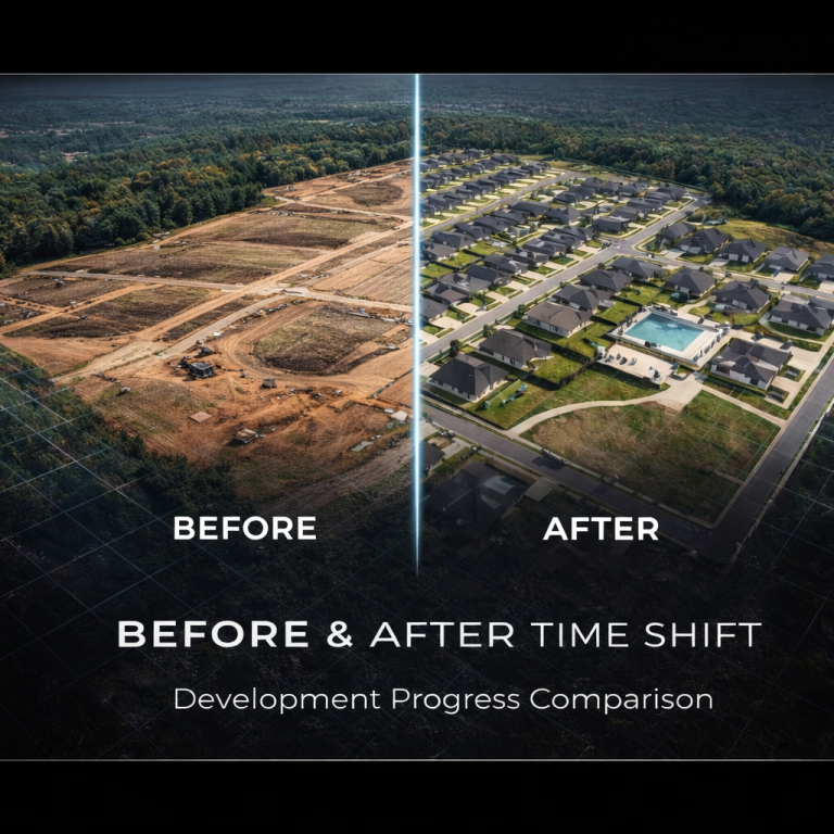
Visually demonstrates site progression over time, allowing leadership and shareholders to see measurable advancement across phases.
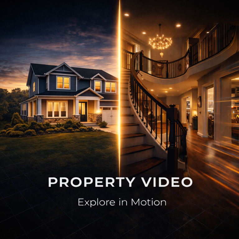
Combines aerial and interior footage to deliver a polished, presentation-ready overview of the property.
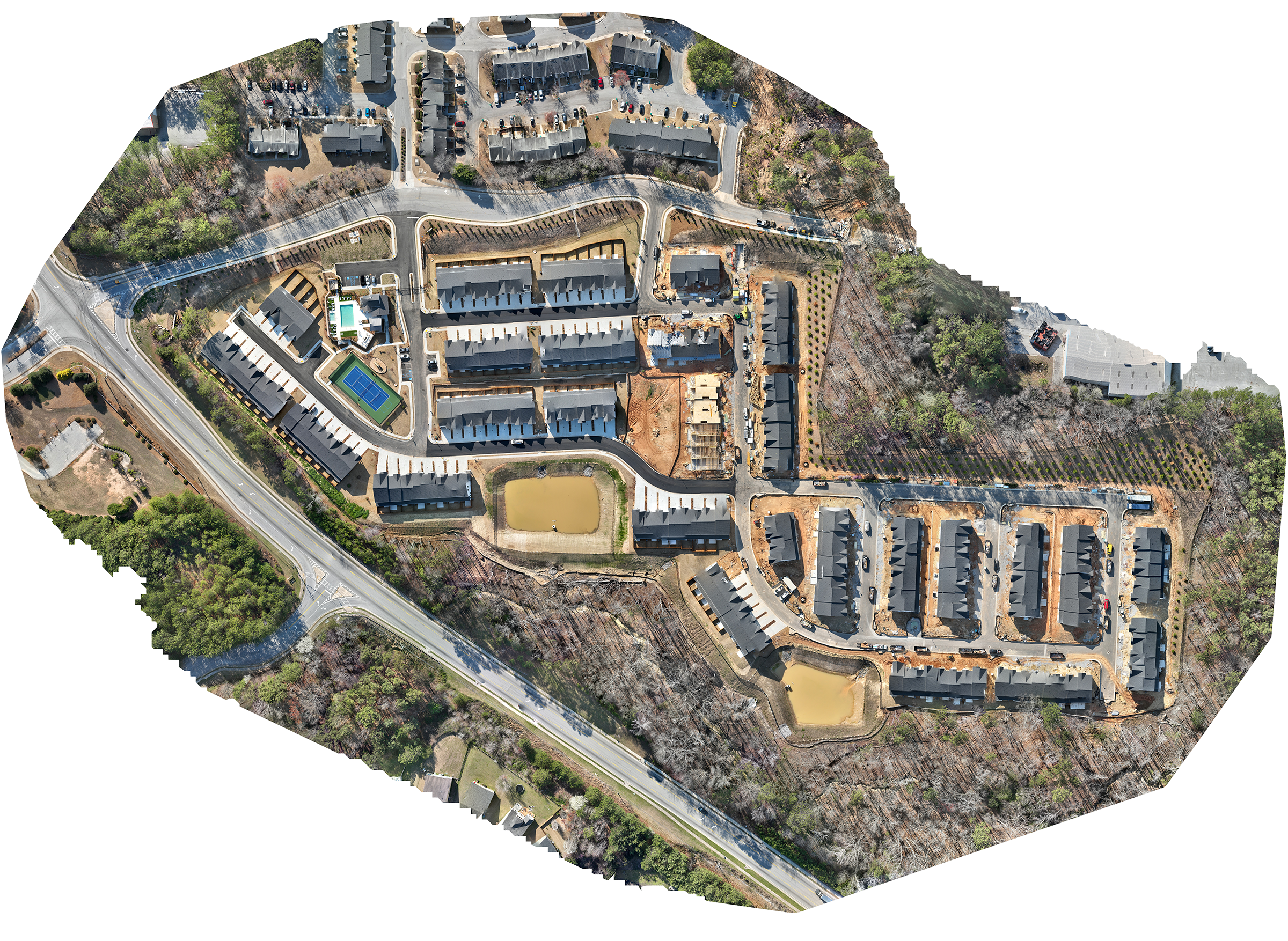
A high-resolution aerial map that provides a clear, top-down view of the entire project area. Ideal for visual documentation, layout reference, and progress tracking.
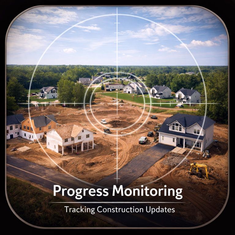
Track site development using high-resolution 2D orthomosaics and interactive 3D models to clearly visualize construction progress over time.
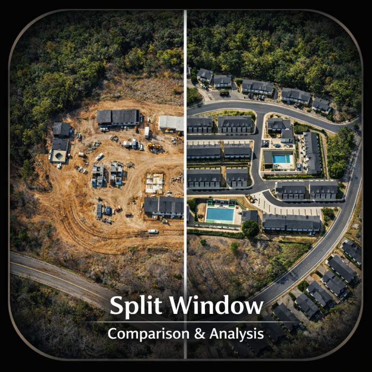
Compare two versions of the same 3D model simultaneously to visualize changes, development progress, or design updates.
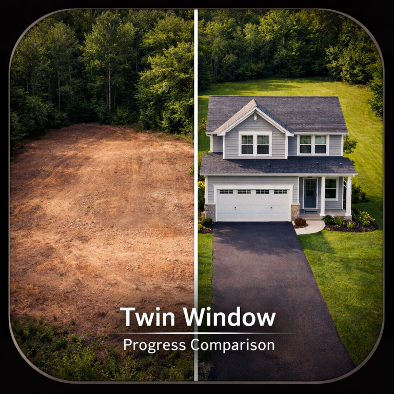
View two versions of a site simultaneously with side-by-side 2D orthomosaics and 3D models to easily analyze construction progress and development changes.